 INSPIRE Metadatensuche Österreich
2024
Type of resources
Available actions
Topics
INSPIRE themes
Keywords
Contact for the resource
Provided by
Years
Formats
Representation types
Service types
Scale
Resolution
-
Subnetz 4009 Bayern OÖ, Straßenabschnitte und Eigenschaften, Verkehrsnetze, ÖVDAT
-
Subnetz 4012 Privat im öffentlichen Besitz OÖ, Straßenabschnitte und Eigenschaften, Verkehrsnetze, ÖVDAT
-
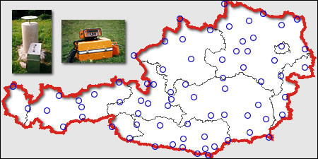
Für sämtliche Festpunkte werden zusätzlich zu den Koordinaten im System der Österreichischen Landesvermessung (Gebrauchssystem des Militärgeographischen Institutes = MGI) sukzessive auch die Koordinaten im global gelagerten internationalen europäischen System ETRS89 in mehreren Realisierungsstufen unterschiedlicher Genauigkeit bestimmt. Die ca. 59.000 Triangulierungspunkte (TP) bilden österreichweit ein dreidimensionales Punktnetz mit einer durchschnittlichen Entfernung von etwa 1,5 km. Von diesen TPs wurden ca. 270.000 Einschaltpunkte (EP) mit einem durchschnittlichen Abstand von 500 m abgeleitet. Stichtag = Erstellungsdatum: Die Daten sind zu diesem Tag der aktuellste Datenbestand des BEV. Dies ist nicht ident mit dem Aufnahme- bzw. Vermessungsdatum.
-

Das Digitale Oberflächenmodell (DOM, engl.: DSM) beschreibt die Erdoberfläche samt allen darauf befindlichen Objekten in Form von Punktmengen, die in einem regelmäßigen Gitter angeordnet und in Lage und Höhe georeferenziert sind. Im Unterschied zum digitalen Geländemodell (DGM) wird somit die Vegetations- und Bebauungsoberfläche dargestellt. Die hochauflösenden ALS-DGM Daten wurden mittels Airborne Laser Scanning - Technologien erfasst und sind ein Kooperationsprodukt der österreichischen behördlichen Geodatenprovider des Bundes und der Länder. Eignung/Nutzung • Planungsgrundlage • Umweltschutz • Nachrichtentechnik • Geologie • Hydrologie • Landwirtschaft • Forstwirtschaft • Kartographie Dies ist eine von insgesamt 55 Kacheln, welche zusammen das Gebiet Österreich abdecken. Stichtag = Erstellungsdatum: Die Daten sind zu diesem Tag der aktuellste Datenbestand des BEV. Dies ist nicht ident mit dem Aufnahme- bzw. Vermessungsdatum. Die Aktualität finden Sie in der zugehörigen Serie unter „Downloads, Ansichten und Links“ in der Aktualitätsübersicht.
-

Das digitale Geländehöhenmodell (DGM, engl.: DTM) beschreibt die Erdoberfläche (natürlicher Boden, ohne Bewuchs) in Form von Punktmengen, die in einem regelmäßigen Gitter angeordnet und in Lage und Höhe georeferenziert sind. Die hochauflösenden ALS-DGM Daten wurden mittels Airborne Laser Scanning - Technologien erfasst und sind ein Kooperationsprodukt der österreichischen behördlichen Geodatenprovider des Bundes und der Länder. Eignung/Nutzung • Grundlage für Orthophotoberechnung • Planungsgrundlage • Umweltschutz • Nachrichtentechnik • Geologie • Hydrologie • Landwirtschaft • Kartographie Dies ist eine von insgesamt 55 Kacheln, welche zusammen das Gebiet Österreich abdecken. Stichtag = Erstellungsdatum: Die Daten sind zu diesem Tag der aktuellste Datenbestand des BEV. Dies ist nicht ident mit dem Aufnahme- bzw. Vermessungsdatum. Die Aktualität finden Sie in der zugehörigen Serie unter „Downloads, Ansichten und Links“ in der Aktualitätsübersicht.
-
Das Digitale Oberflächenmodell (DOM, engl.: DSM) beschreibt die Erdoberfläche samt allen darauf befindlichen Objekten in Form von Punktmengen, die in einem regelmäßigen Gitter angeordnet und in Lage und Höhe georeferenziert sind. Im Unterschied zum digitalen Geländemodell (DGM) wird somit die Vegetations- und Bebauungsoberfläche dargestellt. Die hochauflösenden ALS-DGM Daten wurden mittels Airborne Laser Scanning - Technologien erfasst und sind ein Kooperationsprodukt der österreichischen behördlichen Geodatenprovider des Bundes und der Länder. Eignung/Nutzung • Planungsgrundlage • Umweltschutz • Nachrichtentechnik • Geologie • Hydrologie • Landwirtschaft • Forstwirtschaft • Kartographie Dies ist eine von insgesamt 55 Kacheln, welche zusammen das Gebiet Österreich abdecken. Stichtag = Erstellungsdatum: Die Daten sind zu diesem Tag der aktuellste Datenbestand des BEV. Dies ist nicht ident mit dem Aufnahme- bzw. Vermessungsdatum. Die Aktualität finden Sie in der zugehörigen Serie unter „Downloads, Ansichten und Links“ in der Aktualitätsübersicht.
-
Ein Orthophoto ist eine verzerrungsfreie und maßstabsgetreue Abbildung der Erdoberfläche. OP-Color wurden aus analogen (Bildflüge mit einem mittleren Bildmaßstab von 1:15 000), seit 2010 aus digitalen Luftbildern (Befliegungen ab 2010) in Echtfarbe (RGB), Falschfarbe (CIR - Infrarotnaher Farbbereich) oder 4-Kanalbilder (RGBI) hergestellt. Diese Orthophotos werden in einer Bodenauflösung (Pixelgröße) von 20 cm (ab 2010) oder 25 cm produziert.
-
Das digitale Geländehöhenmodell (DGM, engl.: DTM) beschreibt die Erdoberfläche (natürlicher Boden, ohne Bewuchs) in Form von Punktmengen, die in einem regelmäßigen Gitter angeordnet und in Lage und Höhe georeferenziert sind. Die hochauflösenden ALS-DGM Daten wurden mittels Airborne Laser Scanning - Technologien erfasst und sind ein Kooperationsprodukt der österreichischen behördlichen Geodatenprovider des Bundes und der Länder. Eignung/Nutzung • Grundlage für Orthophotoberechnung • Planungsgrundlage • Umweltschutz • Nachrichtentechnik • Geologie • Hydrologie • Landwirtschaft • Kartographie Dies ist eine von insgesamt 55 Kacheln, welche zusammen das Gebiet Österreich abdecken. Stichtag = Erstellungsdatum: Die Daten sind zu diesem Tag der aktuellste Datenbestand des BEV. Dies ist nicht ident mit dem Aufnahme- bzw. Vermessungsdatum. Die Aktualität finden Sie in der zugehörigen Serie unter „Downloads, Ansichten und Links“ in der Aktualitätsübersicht.