 INSPIRE Metadatensuche Österreich
Geopackage
Type of resources
Available actions
Topics
INSPIRE themes
Keywords
Contact for the resource
Provided by
Years
Formats
Representation types
Update frequencies
Resolution
-
Geplanter Kartierungsumfang 2022: Großflughäfen. An die Europäische Kommission im Dezember 2022 übermitteltes Update.
-
Lärmzonen gemäß Umgebungslärmgesetzgebung für Straßen für die Lärmindizes Lden und Lnight Die Lärmzonen stehen für das gesamte Bundesgebiet zur Verfügung.
-
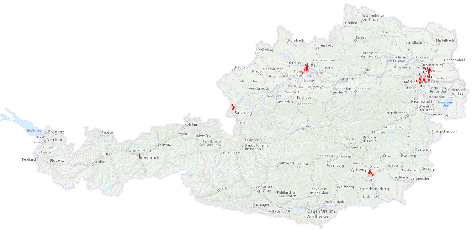
Lärmzonen gemäß Umgebungslärmgesetzgebung für IPPC-Anlagen in Ballungsräumen für die Lärmindizes Lden und Lnight. Die Lärmzonen stehen für die Ballungsräume Graz, Innsbruck, Linz, Salzburg und Wien als Bestandteil des Geodatensatzes für Ballungsräume zur Verfügung.
-
Geplanter Kartierungsumfang 2022: Haupteisenbahnstrecken mit mehr als 30000 Zügen/Jahr. An die Europäische Kommission im Dezember 2022 übermitteltes Update.
-
Lärmzonen gemäß Umgebungslärmgesetzgebung für Flughäfen für die Lärmindizes Lden und Lnight.
-

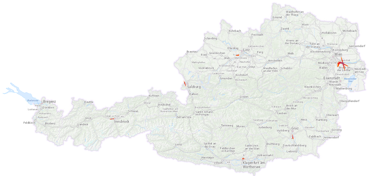
Lärmzonen gemäß Umgebungslärmgesetzgebung für die Eisenbahn und die Straßenbahnen in den Ballungsräumen für die Lärmindizes Lden und Lnight. Die Lärmzonen stehen für das gesamte Bundesgebiet zur Verfügung.
-
Geplanter Kartierungsumfang 2022: Ballungsräume mit mehr als 100000 Einwohnern. An die Europäische Kommission im Dezember 2022 übermitteltes Update.
-
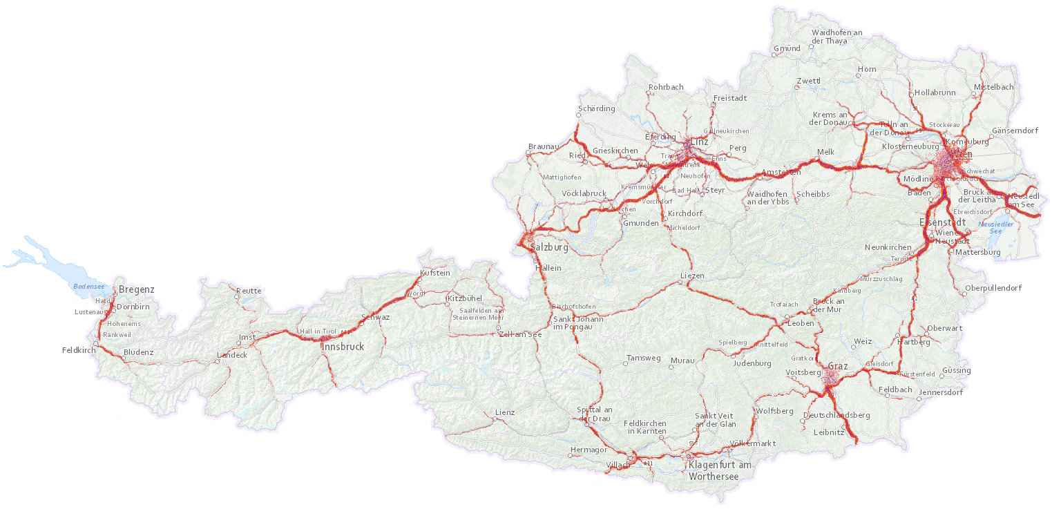
Geplanter Kartierungsumfang 2022: Hauptverkehrsstraßen (Autobahnen und Schnellstraßen sowie Landesstraßen) mit mehr als 3 Millionen Kfz/Jahr. An die Europäische Kommission im Dezember 2022 übermitteltes Update.
-
Ruhige Gebiete gemäß Umgebungslärmgesetzgebung
-
Soil depth refers to the depth of unconsolidated soil layers and is restricted in vertical extent by the occurrence of solid rock, solidified or hardened layers, or a predominant coarse fraction. The Agricultural Soil Map of Austria distinguishes a total of six classes, three primary and three secondary classes. The primary classes comprise "shallow" (<30cm), "medium" (30cm - 70cm), and "deep" (>70cm), while the secondary classes include the transition classes "shallow to medium," "medium to deep," and "highly variable." Soil depth as distinguished in this map refers to the extent to which a manually-operated soil drill (“Pürckhauer”) can be driven into the soil. This should not be confused with the soil depth to which root growth is possible known as the "effective depth" or "physiological depth". Typically, physiological depth extends beyond soil depth, since plant roots can partially penetrate dense layers or layers with a high proportion of coarse material. Nevertheless, the soil depth offers a suitable estimate of the soil volume accessible for root growth, as well as the soil's capacity to retain water and nutrients.