INSPIRE Metadatensuche Österreich
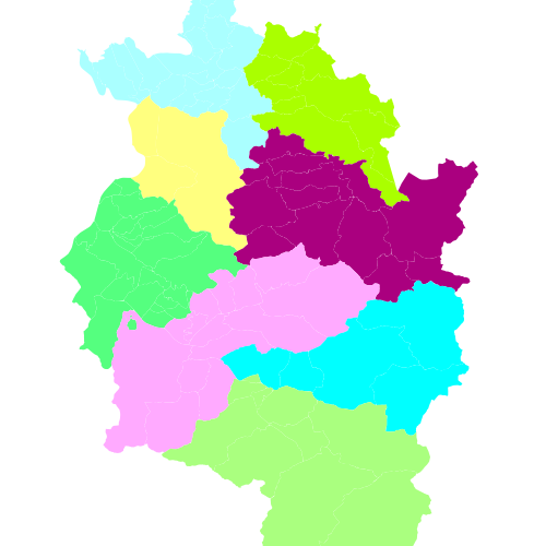
Waldregionen Vorarlberg
Einteilung des Landes - Bezirke - in Waldregionen.
Ist für INSPIRE gemeldet.
Die Attributtabelle weist folgende Felder (mit Definition) auf:
waldregion (string)
Datenquelle: waldregion.shp
Simple
- Datumsangaben (Erstellung)
- 2009-12-14
- Datumsangaben (Überarbeitung)
- 2023-02-20T12:00:00
- Identifikator
- https://data.inspire.gv.at/0025/265c94d8-2099-475d-af1e-f94a623ede3b
+43 (0) 5522 / 754826
https://vorarlberg.at/-/landesamt-fuer-vermessung-und-geoinformation-l-1?article_id=122572
+43 (0) 5574 / 511-925395
https://vorarlberg.at/-/forstwesen-vc
+43 (0) 5574 / 511-925395
https://vorarlberg.at/-/forstwesen-vc
+43 (0) 5574 / 511-925395
https://vorarlberg.at/-/forstwesen-vc
-
VOGIS-Thema
-
-
Forstwesen
-
-
VOGIS-Unterthema
-
-
Wald
-
-
GEMET - INSPIRE themes, version 1.0
-
-
Bewirtschaftungsgebiete/Schutzgebiete/geregelte Gebiete und Berichterstattungseinheiten
-
- Keywords
-
-
Waldkarte
-
-
GEMET - Concepts, version 3.1
-
-
Wirtschaftsgeographie
-
Wald
-
Laubwald
-
wirtschaftliche Rechte
-
Waldwirtschaft
-
Nadelwald
-
-
Spatial scope
- Zugriffseinschränkungen
- Benutzerdefinierte Einschränkungen
- Andere Einschränkungen
- Der öffentliche Zugang zu diesem Produkt unterliegt keinen Einschränkungen.
- Nutzungseinschränkungen
- Benutzerdefinierte Einschränkungen
- Andere Einschränkungen
- Namensnennung 4.0 International (CC BY 4.0)
- Andere Einschränkungen
-
(c) Land Vorarlberg
- Räumliche Darstellungsart
- Vektor
- Massstabszahl
- 5000
- Sprache
- Deutsch
- Thematik
-
- Biologie
))
- Identifikator des Referenzsystems
- http://www.opengis.net/def/crs/EPSG/0/31254
- Identifikator des Referenzsystems
- http://www.opengis.net/def/crs/EPSG/0/3035
- Identifikator des Referenzsystems
- http://www.opengis.net/def/crs/EPSG/0/4036
- Abgabeformat
-
-
ESRI Shapefile
(
-
)
-
ESRI Shapefile
(
-
)
- Online
-
Darstellungsdienst Waldregionen Vorarlberg
(
OGC:WMS-http-get-capabilities
)
Darstellungsdienst Waldregionen Vorarlberg als WMS
- Online
-
Downloaddienst Waldregionen Vorarlberg
(
WWW:DOWNLOAD-1.0-http--download
)
Downloaddienst Waldregionen Vorarlberg als atom-feed
- Online
- Geoserver-WMS ( OGC:WMS-http-get-capabilities )
- Online
- Geoserver-WFS ( OGC:WFS-http-get-capabilities )
- Online
-
Shapefile-Download
(
WWW:DOWNLOAD-1.0-http--download
)
Achtung !! max. Features = 50.000
- Bezugsebene
- Datenbestand
Konsistenz des Wertebereichs
- Verfahrensidentifikator
- INSPIRE / Conformity_001
Konformitätsergebnis
- Datumsangaben (Publikation)
- 2010-12-08
- Erklärung
-
siehe Referenzdokument (INSPIRE Technical Guidelines)
- Bestanden
- Ja
- Erläuterung
-
Hersteller: Amt der Landesregierung, Abteilung Vc - Forstwesen
- Metadatensatzidentifikator
- 265c94d8-2099-475d-af1e-f94a623ede3b XML
- Sprache
- Deutsch
- Hierarchieebene
- Datenbestand
- Datum
- 2023-11-24T09:44:24
- Bezeichnung des Metadatenstandards
-
ISO19115
- Version des Metadatenstandards
-
2003/Cor.1:2006
+43 (0) 5522 / 754826
https://vorarlberg.at/-/landesamt-fuer-vermessung-und-geoinformation-l-1?article_id=122572
Overviews
Räumliche Ausdehnung
Provided by