INSPIRE Metadatensuche Österreich
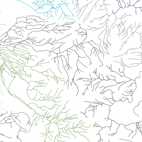
Fischereikataster Vorarlberg
02.07.2019
Dieser Datensatz beinhaltet alle Geometrien der Vorarlberger Fischereireviere und der dazugehörenden Fischereireviernummern.
Ist für INSPIRE gemeldet.
Wichtige Felder und Datentypen der Attributtabelle (jene, die inhaltliche Informationen enthalten):
REVIER ... Nummer des Fischereireviers
scale .... Angabe des Maßstabes, für das diese Polygone optimal geeignet sind
5000 ... M > 1:10.000
15000 ... M 1:10.000 bis 1:20.000
25000 ... M 1:20.000 bis 1:30.000
40000 ... M 1:30.000 bis 1:50.000
75000 ... M 1:50.000 bis 1:100.000
150000 ... M 1:100.000 bis 1:250.000
300000 ... M < 250.000
Datenquelle: fischereireviere.shp
INSPIRE
Identification
- Metadatensatzidentifikator
- 1cd76e32-977e-4f0a-827c-ba0fa0e333f0 XML
- Hierarchieebene
- Datenbestand
Online resource
- resource_protocol
-
OGC:WMS-http-get-capabilities
- resource_protocol
-
WWW:DOWNLOAD-1.0-http--download
- resource_protocol
-
OGC:WMS-http-get-capabilities
- resource_protocol
-
OGC:WFS-http-get-capabilities
- resource_protocol
-
WWW:DOWNLOAD-1.0-http--download
Resource identifier
- Sprache
- Deutsch
- Räumliche Darstellungsart
- Vektor
Encoding
- Format
-
ESRI Shapefile
- Version
-
-
Classification of data and services
- Thematik
-
- Binnengewässer
Classification of data and services
Coupled resource
Coupled resource
Classification of data and services
Coupled resource
Coupled resource
Keywords
-
GEMET - INSPIRE themes, version 1.0
-
-
Bewirtschaftungsgebiete/Schutzgebiete/geregelte Gebiete und Berichterstattungseinheiten
-
-
VOGIS-Thema
-
-
Wasser
-
-
VOGIS-Unterthema
-
-
Fischerei
-
-
GEMET - Concepts, version 3.1
-
-
Fischerei
-
Fischereiwirtschaft
-
Binnenfischerei
-
Fischereirecht
-
Fischereilizenz
-
-
Spatial scope
Other keywords
- Keywords
-
-
Fischereirevier
-
Geographic coverage
))
Temporal reference
Temporal extent
- Begin
- 2013-01-01
- End
- 2017-03-31
Temporal extent
- Datum (Erstellung)
- 2014-10-17
- Datum (Überarbeitung)
- 2019-11-15T12:00:00
Quality and validity
- Lineage
-
Hersteller: Institut für Umwelt und Lebensmittelsicherheit, Abteilung V - Informatik
Datengrundlage für die Erstellung der Geometrien waren das "Gewässernetz 2012" und der "Seen"-Datensatz.
- Massstabszahl
- 1000
Conformity
Conformity
Conformity
Conformity
Conformity
Conformity
- Explanation
-
siehe Referenzdokument (INSPIRE Technical Guidelines)
Restrictions on access and use
- Access constraints
- Der öffentliche Zugang zu diesem Produkt unterliegt keinen Einschränkungen.
- Access constraints
- Namensnennung 4.0 International (CC BY 4.0)
- Access constraints
-
(c) Land Vorarlberg
Responsible organization (s)
Contact for the resource
- Organisation name
-
Vorarlberg, Amt d. LReg., Abteilung VIId - Wasserwirtschaft
- Organisation name
-
Vorarlberg, Landesamt für Vermessung und Geoinformation, Abteilung Geoinformation
- Organisation name
-
Vorarlberg, Amt d. LReg., Abteilung VIId - Wasserwirtschaft
- Organisation name
-
Vorarlberg, Amt d. LReg., Abteilung VIId - Wasserwirtschaft
Metadata information
Contact for the metadata
- Organisation name
-
Vorarlberg, Landesamt für Vermessung und Geoinformation, Abteilung Geoinformation
- Datum
- 2023-11-24T09:09:33
- Sprache
- Deutsch
SDS
Conformance class 1: invocable
Access Point URL
Endpoint URL
Technical specification
Conformance class 2: interoperable
Access constraints
Limitation
Use constraints
Limitation
Responsible custodian
Contact for the resource
Overviews
Räumliche Ausdehnung
Provided by