INSPIRE Metadatensuche Österreich
Flächenwidmungsplan Vorarlberg - Flächen
Umfasst alle Grundstücke Vorarlbergs und deren Widmungen und Ersichtlichmachungen.
Ist für INSPIRE gemeldet.
Wichtige Felder und Datentypen der Attributtabelle:
GEMEINDE (string) Gemeindename
STAND (string) offizielles Datum
FLAECHE (double) Fläche des Grundstücks
WI_EM_SIG (string) Widmung - Signatur
WI_EM_TXT (string) Widmung - Text
WI_EM_KN (string) Widmungs- oder Ersichtlichmachungs-Kategorie
WI_EM_UKN (string) Widmungs- oder Ersichtlichmachungs-Unterkategorie
VORBE_WI (string) Art der Vorbehaltsfläche
VORBE_SIG (string) Art der Vorbehaltsfläche - Signatur
FS_TXT (string) Freifläche Sondergebiet - Nähere Beschreibung
LEGENDE (string) Zusatzinformationen zu Grundstück und eventueller Umwidmung
INFO_TXT (string) Zusatzinformationen
Datenquelle: fwp_flaeche.shp
INSPIRE
Identification
- Metadatensatzidentifikator
- 85bd045b-8857-4388-bc07-0fccd5a29eb1 XML
- Hierarchieebene
- Datenbestand
Online resource
- resource_protocol
-
OGC:WMS-http-get-capabilities
- resource_protocol
-
WWW:DOWNLOAD-1.0-http--download
- resource_protocol
-
OGC:WMS-http-get-capabilities
- resource_protocol
-
OGC:WFS-http-get-capabilities
- resource_protocol
-
WWW:DOWNLOAD-1.0-http--download
- resource_protocol
-
WWW:LINK-1.0-http--link
Resource identifier
- Sprache
- Deutsch
- Räumliche Darstellungsart
- Vektor
Encoding
- Format
-
ESRI Shapefile
- Version
-
-
Classification of data and services
- Thematik
-
- Planungsunterlagen, Kataster
Classification of data and services
Coupled resource
Coupled resource
Classification of data and services
Coupled resource
Coupled resource
Keywords
-
GEMET - INSPIRE themes, version 1.0
-
-
Bodennutzung
-
-
VOGIS-Thema
-
-
Raumplanung
-
-
VOGIS-Unterthema
-
-
Flaechenwidmung
-
-
GEMET - Concepts, version 3.1
-
-
Flächennutzungsplanung
-
Flächennutzung
-
Flächennutzungsplan
-
Flächenwidmung
-
-
Spatial scope
Other keywords
- Keywords
-
-
Flächenwidmung - Flächen
-
Geographic coverage
))
Temporal reference
Temporal extent
Temporal extent
- Datum (Erstellung)
- 2010-01-19
- Datum (Überarbeitung)
- 2019-11-15
Quality and validity
- Lineage
-
Hersteller: Vorarlberg, Amt d. LReg., Abteilung VIIa - Raumplanung
- Massstabszahl
- 5000
Conformity
Conformity
Conformity
Conformity
Conformity
Conformity
- Explanation
-
siehe Referenzdokument (INSPIRE Technical Guidelines)
Restrictions on access and use
- Access constraints
- Der öffentliche Zugang zu diesem Produkt unterliegt keinen Einschränkungen.
- Access constraints
- Namensnennung 4.0 International (CC BY 4.0)
- Access constraints
-
(c) Land Vorarlberg
Responsible organization (s)
Contact for the resource
- Organisation name
-
Vorarlberg, Amt d. LReg., Abteilung VIIa - Raumplanung
- Organisation name
-
Vorarlberg, Landesamt für Vermessung und Geoinformation, Abteilung Geoinformation
- Organisation name
-
Vorarlberg, Amt d. LReg., Abteilung VIIa - Raumplanung
- Organisation name
-
Vorarlberg, Amt d. LReg., Abteilung VIIa - Raumplanung
Metadata information
Contact for the metadata
- Organisation name
-
Vorarlberg, Landesamt für Vermessung und Geoinformation, Abteilung Geoinformation
- Datum
- 2023-12-05T09:30:29
- Sprache
- Deutsch
SDS
Conformance class 1: invocable
Access Point URL
Endpoint URL
Technical specification
Conformance class 2: interoperable
Access constraints
Limitation
Use constraints
Limitation
Responsible custodian
Contact for the resource
Overviews
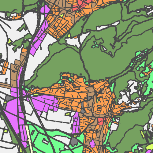
Räumliche Ausdehnung
Provided by